
Reflecting on the devastating floods in Spain
In late October 2024, Spain experienced catastrophic flooding, particularly affecting the eastern regions of Valencia, Murcia, and Castilla-La Mancha. The deluge resulted in significant loss of life, with at least 227 fatalities (La Moncloa, 2024). The flooding caused widespread devastation, submerging entire towns, destroying infrastructure, and displacing thousands of residents. The Spanish government declared a state of emergency, mobilising national resources to aid rescue and recovery efforts. Preliminary estimates suggest economic losses exceeding €10 billion, encompassing damages to homes, businesses, agriculture, and public infrastructure (AP News, 2024a). This catastrophic event has prompted urgent discussions on enhancing flood preparedness and resilience in the face of the increasing threat from severe weather.
Click here to read this report in Spanish.
Overview and Timeline
The late October 2024 flooding in Spain ranks as one of the country's most severe natural disasters in recent decades. Triggered by a so-called DANA (Depresión Aislada en Niveles Altos) event (see below for an explanation), the flooding brought torrential rains, causing rivers to overflow and triggering severe flash floods across eastern and south-eastern regions (El Pais, 2024). The hardest-hit areas include Valencia, Murcia, and parts of Castilla-La Mancha, with rainfall totals exceeding 500 mm within 48 hours.
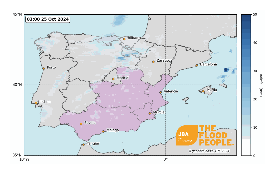
The event began on 27 October 2024 with heavy rain falling over already drought-hardened soils, leading to flash floods in urban and rural areas. By 29 October, the storm reached peak intensity, delivering over 400 mm of rain in some areas within 24 hours. The rain gauge in Chiva (west of Valencia) received 122 mm of rain in one hour and 461 mm of rain over 24 hours (El Pais, 2024). Rivers such as the Turia, Júcar, and Segura overflowed, inundating towns and villages, destroying homes, and sweeping away vehicles. Emergency services carried out large-scale evacuations as infrastructure, including roads and railways, was severely damaged (AP News, 2024b).
The storm began to dissipate on 31 October, but residual flooding and landslides persisted, hampering rescue and recovery operations. Over the following weeks, authorities focused on clearing debris, restoring critical services, and assessing the widespread damage, which included substantial losses in agriculture and infrastructure (AP News, 2024a). The Spanish government approved a €10.6 billion recovery package to support the affected regions, as discussions on improving flood resilience and mitigation strategies gained urgency (Euronews, 2024a).
Spain’s Consortium for Insurance Compensation, the public-private entity responsible for covering insurance claims related to extreme events such as floods, has estimated a minimum payout of €3.5 billion in response to the recent flooding (Consorcio de Compensación de Seguros, 2024). To date, the consortium has received nearly 200,000 claims for flood-related damages, with 60% of claims for vehicles and 31% for residential properties. Spain’s Association of Insurance Companies has noted that this event is likely to set a record for insurance payouts, underscoring the unprecedented scale of the disaster.
Additionally, in early November, the province of Málaga in Andalusia faced torrential rains resulting in significant flooding. The city of Málaga and surrounding areas were particularly affected, with reports of submerged streets and disrupted transportation networks. The national weather agency issued red alerts, and thousands of residents were evacuated as a precautionary measure (Euronews, 2024b).
What caused the heavy rainfall in the Valencia region?
A DANA (Depresión Aislada en Niveles Altos), or “cold drop”, occurs when an intrusion of a cold air mass from higher latitudes becomes isolated from the polar jet stream and remains trapped in the upper atmosphere (Figure 2). When the cold air interacts with warm, humid air from sources like the Mediterranean Sea, it creates atmospheric instability (Live Science, 2024). The result is intense convection, leading to severe weather conditions such as torrential rainfall, thunderstorms, hail, and occasionally strong winds. These systems are relatively common in the Mediterranean region in autumn, where any cold intrusion aloft can interact with the still warm land and sea at the surface.

DANAs are notable for their slow movement, which can prolong heavy rainfall over specific areas, causing localised flooding, landslides, and widespread destruction. Their impact is often exacerbated by warmer-than-average sea temperatures, which enhance moisture availability and intensify rainfall (MetMatters, 2024). With warming seas and a warmer atmosphere able to hold more water vapour, climate change would be expected to increase the severity of DANAs and therefore increase the risks of these destructive events in vulnerable regions (WMO, 2024). Indeed, one preliminary analysis estimated that the rainfall intensity in the Valencia event was made twice as likely by the 1.3°C of global warming that we have experienced (WWA, 2024).
Notable historical events
Spain has faced numerous devastating flood events throughout its history, often shaped by a combination of natural conditions and human factors. These events have caused widespread fatalities, infrastructure damage, and displacement, and have highlighted the vulnerabilities of certain regions to extreme weather. The table below summarises some of the most notable flood events, and their causes and impacts, providing context for the severity of the 2024 floods.

The recent 2024 floods in Spain, particularly in Valencia and Murcia, are comparable to the 2019 DANA floods in terms of meteorological conditions including rainfall intensity, but surpass many past events in terms of economic damage, geographic extent, and infrastructure destruction. However, the 1957 Valencia flood remains one of the most devastating in Spain's history, given its transformative impact on urban planning and flood management policies.
Similar magnitude events have occurred in other Mediterranean countries. The 2023 Thessaly floods in Greece caused by Storm Daniel resulted in over €4 billion in damages. The 2023 Emilia-Romagna floods in Italy displaced tens of thousands and caused over €6 billion in losses. These events emphasise that the Mediterranean region may be increasingly vulnerable to extreme weather as the climate changes.
Understanding uncertainty: Lessons from Valencia
Flood catastrophe models are tools used to estimate financial losses from flood events by integrating hazard, exposure, vulnerability, and financial impacts. However, numerous uncertainties exist in each component, which, when propagated through the modelling chain, can drive large uncertainties in the loss estimation. Here, we explore flood catastrophe model loss estimates from disasters like those in Valencia, with a focus on three sources of uncertainty: hazard intensity, vulnerability and climate change.
How uncertainty impacts loss estimates
To explore how these uncertainties affect loss predictions, we ran two analyses with our flood catastrophe model, the JBA Global Flood Model.
Firstly, we ran a Baseline Analysis. Using a baseline event set without considering uncertainty, we estimate a 200-year return period loss of $168.3M (€160.4M) for a location-level residential portfolio in Spain. Total Insured Values were derived using Gross Domestic Product as a proxy.
Secondly, we ran an Uncertainty-Inclusive Analysis. For this, we varied three inputs to our model that correspond to our three sources of uncertainty:
- Hazard intensity
In this case, hazard intensity is simply flood depth. This is determined by a complex set of physical models and data processing, all of which impart uncertainty to the value. To explore the uncertainty in hazard intensity, we simply perturbed the flood depths at each point by sampling through a uniform distribution. - Vulnerability curves
Vulnerability curves translate hazard intensity to damage to an asset by means of a damage ratio, which converts hazard intensity to a loss, usually expressed as a fraction of the total insured value. Typically, industry vulnerability curves use flood depth as the damage-driving factor. However, in flood events like that in Valencia, intense rainfall and urban surfaces can result in high water velocity, sediment and debris accumulation, amplifying destructive forces beyond that caused by flood depth.
To explore the uncertainty from our incomplete understanding of how factors like flood depth, water velocity, debris and contamination contribute to damage, we perturbed the vulnerability functions through their damage ratios (sampling using a beta distribution). We note that a more complete study would use specific vulnerability functions that account for these additional factors. - Climate change
Flood catastrophe models capture the range of plausible events through an extensive catalogue, called the event set. In many locations, climate change will likely intensify flood events. However, as event sets are built from the frequency and severity statistics of past flood events, they may fail to reflect any more recent shifts due to climate change, introducing uncertainty in estimating both frequent and rare event losses.
To explore how a climate change-driven shift in frequency and severity of flood events can impact loss uncertainty, we ran the Global Flood Model with event sets conditioned for a climate 2°C above pre-industrial temperatures (i.e., ~0.7°C warmer than today). The impact of climate change on the flood hazard is uncertain (for both magnitude and spatial patterns), especially for the Mediterranean region (e.g., Zappa and Shepherd, 2017). Therefore, we created three climate-conditioned event sets using the outputs of three global climate models (GFDL-ESM4, MRI-ESM2-0, and UKESM1-0-LL) to represent different “storylines” for climate change’s impact. Broadly, all these climate models project broad-scale climate-driven decreases for river flow and more localised decreases for precipitation, among larger areas of precipitation increase. The precise areas and magnitude of these changes differs substantially between models.
Running the Global Flood Model 300 times with different combinations across the three inputs, we produced a distribution of sample loss estimates, shown in Figure 3. The baseline loss estimate (solid blue line), excluding uncertainty, falls in the lower tail of the loss distribution. Taking these loss results at face value, if this was considered the view of risk, there would be a high chance of underestimating losses. On the other hand, the mean loss across the 300 simulations (dashed blue line) provides a more conservative estimate, but by itself does not capture the extreme possibilities.

What drives extreme losses?
Parallel coordinate plots can help us explore the drivers behind extreme outcomes more clearly, identifying combinations of inputs that result in extreme losses. A parallel coordinate plot for this analysis is shown in Figure 4. It consists of parallel vertical axes crisscrossed by lines running left to right. The first three vertical axes represent, respectively, the damage ratio, hazard intensity (both with the different perturbation factors indicated on the axes), and flood event set inputs (each value indicated on this axis represents a different event set; see caption).
The right-hand vertical axis shows the portfolio-level loss estimates at the 200-year return period . Each crisscrossing line represents one of the 300 simulations of the catastrophe model, each with its particular combination of the three inputs as specified on the three left-hand vertical axes, arriving at the loss value on the right-hand axis.
In Figure 4, we highlight in purple the combinations of inputs that lead to the most extreme losses, defined as those exceeding the 97.5 percentile of the sample loss distribution. These extreme losses are primarily associated with the vulnerability component and all the purple lines start from where the vulnerability is the greatest.
While extreme losses are possible from all the event sets, most are generated from the baseline event set where, as noted above, the hazard intensity is generally greater than for the climate-conditioned event sets. Whether or not this is how climate change is impacting the flood hazard across Spain is itself uncertain. A fuller analysis should investigate other plausible futures, including using evidence drawn from observations (e.g., WWA, 2024).
At the same time, extreme losses are still possible for a reduced hazard if they are combined with high vulnerability. If we assume that high vulnerability is a proxy for an intensified flood hazard (e.g., allowing for damage from high-velocity water flows), then this “high vulnerability” is relevant to the recent Valencia floods.

While a more detailed investigation might better constrain the plausible ranges for the parameters we studied (as well as identifying other drivers of uncertainty), this analysis underscores how sensitive loss estimates are to the assumptions that we use to model them. As we have demonstrated, ignoring this uncertainty could lead to underestimating potential losses, leaving communities and stakeholders unprepared.
Conclusion
Catastrophic flooding, as we have seen in Valencia, will continue to happen, perhaps with changing intensity and regularity. Our knowledge and understanding of these events will increase though, and with improved knowledge and understanding, society will hopefully be better prepared, including through improved early warning and increased resilience. For risk managers and catastrophe model users in all industries, understanding the uncertainties in your loss estimates can lead you to make better decisions, ensuring society is better prepared for a changing climate.


