
Severe downpour triggers flooding and landslides across South Korea
From 16 July 2025 torrential rains hit South Korea over a 5-day period, leading to record-breaking hourly rainfall and resulting in the deaths of at least 18 people, with a further nine still missing (New York Times, 2025).
The heavy rainfall triggered floods and landslides across the southwestern regions, with reports of 600-800mm of rain since Wednesday, 16 July (New York Times, 2025; Sky News, 2025). The level of accumulated rainfall in Seosan, Chungnam, over the period of 16-17 July reached 518.9mm, which is equivalent to approximately 40% of the annual rainfall (Hani, 2025).
Meteorological overview
The torrential rains that hit South Korea broke records with Seosan recording the highest ever ‘rainfall per hour’ since 1904 (Lifestyle Asia, 2025). This heavy rainfall has been a result of the “Changma” (East Asian Summer Monsoon) period that affects South Korea from late June to late July, caused by two contrasting air masses – the North Pacific anticyclone moved across the Korean Peninsula towards the humid air pushed in by the westerly winds (Korea Times, 2025a). Between the air masses, fast winds at an altitude of about 1.5km increased rainfall by supplying a large amount of water vapour, resulting in torrential rain (Hani, 2025).
During this year’s monsoon season, heavy rainfall swept across southern South Korea, with some of the most intense downpours concentrated around Seosan in Chungcheong Province and Gwangju further south. Between 16 and 18 July 2025, Seosan recorded a staggering 520mm of rainfall, the highest total among all monitored stations.

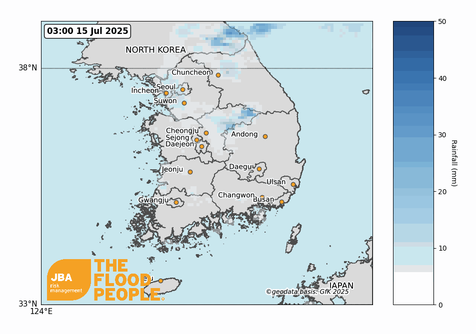
The rainfall observations shown in Figure 2 are based on a single representative observation station for each administrative unit (either a district or province). While it may not fully represent the total volume received across the entire area, they clearly illustrate the spatial pattern of the monsoon system during this event.
Impact summary
The floods across South Korea as a result of heavy rains during the country’s monsoon or Changma season had widespread impacts across several regions. There were impacts seen across the country, with the central and southern regions most severely affected. These included the South Chungcheong Province, South Gyeongsang Province, Gyeonggi Province, Chungcheong Province, and South Jeolla Province. Six districts were declared as special disaster zones after nearly a week of torrential rains beginning on 16 July (Reuters, 2025).
Early reports on 17 July noted impacts across central regions, with two fatalities and 1,000 residents evacuated. As of 18 July, over 5,000 people had been evacuated across cities and provinces. The heavy rains had triggered flash floods and landslides across the country. The heavy rain caused landslides in Cheongyang and Yesan in the South Chungcheong Province, damaging roads and farms. More than 1,382 residents in the region were evacuated, mudslides and flooding cut off access to highways and railways (Korea Times, 2025b; Korea Times, 2025c). Further reports of landslides emerged in southern Sancheong County on 19 July, including one that inundated a village and resulted in a fatality. A separate landslide in a nearby village claimed the lives of two more people (Korea Times, 2025d). Floods and a landslide in the town of Gapyeong, northeast of the capital, on Sunday, 20 July, caused 1 fatality and left two people missing, and another 24 people stranded (Sky News, 2025).
The number of deaths had risen to 17 by 20 July, 4 days since the start of the heavy rain. The Ministry of Interior and Safety reported that there had been 19 fatalities and 9 people remain missing as of the morning of 22 July. There were still 2,549 people displaced across the country (Reuters, 2025; YNA, 2025). With more than 14,000 people needing shelter during the 5-day deluge, the torrential rains have caused damage to 6,752 buildings. In one of the worst-hit areas, Sancheong County, 10 people died due to flash floods, landslides, and collapsed buildings (Earth.org, 2025).
The impact of the floods on farmland and agricultural industry has been widely reported. As a result of the heavy rains, there was a total of 29,448 hectares of agricultural land inundated (Korea Times, 2025e). Vehicle damage during the event exceeded expectations, with more than 3,131 vehicles reported damaged between 16 and 21 July. Estimated losses total around 30 billion South Korean won (approximately USD 23 million) (Korea Times, 2025f).
Historical events
Seosan, one of the cities hardest hit by the floods, recorded an unprecedented 439mm of daily rainfall on 17 July 2025 — nearly 160% higher than its previous record set in 1999 (Table 1). A similar extreme was observed in Gwangju, where rainfall peaked at 426mm, setting a new station record (Table 2).
These extraordinary values underscore how even well-established seasonal monsoons can now drive unprecedented climatic extremes, signalling the intensifying influence of a changing climate.


There have been notable flood events across South Korea in recent years: 2020, 2022, 2023 and 2024. Each of these events has been caused by heavy rainfall similar to the current flood event.

2025 South Korea Flood Map update
The JBA South Korea Flood Map has recently been updated and is available to clients and includes enhanced methodology and current insights to support a better understanding of the flood risk across the region. As part of the 2025 update, 446 defences were identified following expert review of the area, demonstrating the amount of funding that has been put into defending South Korea from future floods.


