
Intense rainstorms bring massive floods to north-east US
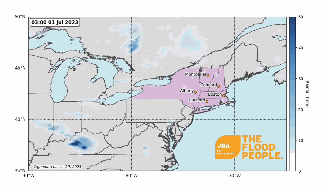
Relentless rainfall in several north-eastern US states has flooded roads, triggered evacuations and halted some airline travel. One person was killed in New York whilst trying to leave her home (Guardian, 2023). Eleven million people in the New England region remained under flood watch as of 11 July 2023 as almost 250mm (10 inches) of rain fell in New York’s Hudson Valley (NBC News, 2023).
In Vermont, one of the worst affected areas, more than 3,100 electric customers suffered power outages (Vermont Public, 2023). Vermont’s Governor Phil Scott said that the flood waters surpassed levels that were seen during 2011’s Hurricane Irene (Vermont Government, 2023).
President Biden declared an emergency in the State of Vermont, enabling Federal assistance to assist the ongoing response efforts led by the State and local authorities (The White House, 2023). Initial estimates of the economic losses indicate that the event could have caused between $3 billion and $5 billion-worth of damage (AccuWeather, 2023).
Event overview
After a powerful storm, the north-east US was hit by severe flooding on 9 and 10 July, causing mountain rivers to overflow into various towns across Vermont (The Conversation, 2023). According to the National Weather Services (NWS), in those two days, Plymouth recorded 230mm of rain, Andover 225mm, Montpelier Airport 173mm and Ludlow 158mm, with further rain being forecast in the coming days. The level of the Winooski River at Montpelier increased by 4.3m in just 20 hours (FloodList, 2023).
More than 1,000 flights across the north-eastern region (including to New York City’s LaGuardia and Boston’s Logan airports) were either delayed or cancelled due to rains. Train services were also disrupted as the National Railroad Passenger Corporation, Amtrak, suspended its service between New York City and Albany due to flooding-inflicted damaged tracks (Reuters, 2023).
In Vermont, thousands of businesses and houses were destroyed – in certain places, water levels rose to waist height as Montpelier was put under Boil Water Notice by the Government (Time, 2023). So far in Vermont, more than 100 evacuations have taken place and over 200 people have had to be rescued. The state’s commissioner of public safety stated that the damage is significant, and the recovery could take years (BBC, 2023).
What caused the event
Prior to 9 July there was high rainfall which left the ground across New England saturated. Towards the end of June, many rainfall stations had received 150-300% more rain than is normal for this time of year (Washington Post, 2023).
An unseasonably strong jet stream caused the surface pressure to drop and form an intense low-pressure system over the north-eastern US. A "moisture plume” develops as the system intensifies, consisting of warm, moist air sourced from the Gulf of Mexico and north-western Atlantic Ocean. Moisture plumes are similar phenomena to “atmospheric rivers” that are common on the west coast of US and resulted in flooding in California earlier this year. A blocking high-pressure system over Greenland meant this deepening low-pressure system slowly tracked north-east from 9 to 11 July, leading to high precipitation rates over an extended period.
Vermont is particularly susceptible to flooding as its terrain is characterised by slopes and valleys. Rainfall accumulates to greater depths as it is channeled over a smaller area, compared to if the terrain was flat. Also, the steep topography increases the velocity of surface runoff that rapidly flows into rivers, causing them to overflow their banks, which increases the risk of flooding and the likelihood of landslides.

Historical events
New England and Vermont in particular have experienced several major floods in recent history, most of them associated with hurricanes. Two of the most damaging events, 1927’s Great Flood, still considered the worst flood event in Vermont’s history; and 2011’s Hurricane Irene, were preceded by rainfall totals above average in the previous months, saturating the soil and increasing the likelihood of surface runoff.

Return period analysis
JBA conducted Extreme Value Analysis on historic rainfall and streamflow data in order to estimate the return period of the event, focusing on Montpelier, VT. We fit a Weibull distribution to a 44-year daily rainfall climate data timeseries from NOAA (2023) to produce a rainfall exceedance probability curve near Moretown just east of Montpelier. The curve is shown by the solid orange line in Figure 3, with the 70th percentiles given by the dashed lines. The observed 24-hour rainfall total of 118.6 mm at the Mad River recording station (shown by the blue line) suggests around a 1-in-150-year rainfall event at this location.

The exceedance probability of streamflow on the Winooski River near Montpelier was calculated using daily mean watercourse discharge data from the United States Geological Survey (USGS, 2023). The data were fit with Generalised Pareto Distributions to produce an exceedance probability curve in Figure 4. This location recorded streamflow with estimated return periods of around 200 years during the event.

Climate change impacts
One impact of climate change is increased bursts of heavy rainfall, meaning that events that would previously have a 1-in-100-year return period are occurring more frequently. The IPCC predicts that heavy precipitation will increase by 7% for every 1°C of warming (IPCC, 2023).
Climate change may also alter the behaviour of jet streams that depend on temperature differences between the equator and poles to move (CNN, 2023). Temperature differences between some areas are decreasing as some areas experience faster warming. Such decreases in temperature difference potentially result in jet streams being “stuck” in position, causing extreme rainfall to persist over an area, increasing the likelihood of floods.
JBA flood hazard maps
JBA have national 5m resolution river, surface water and coastal storm surge flood hazard maps for the US. Figure 5 shows that JBA’s storm river flood and surface water maps capture areas known to have flooded as a direct result of the July 2023 storm.

This report is accompanied by a flood footprint for the event - detailing extents and depths of the flooding in areas affected. Download it via our Client Portal or request a copy by emailing eventresponse@jbarisk.com.
This report is covered by JBA’s website terms – please read them here.
JBA can help you understand your view of flood risk
To better understand the impact of climate change on US flood risk going forwards, JBA has a suite of Flood Data and Probabilistic Flood Models available that represent both baseline and future flood risk. These data and models provide in-depth insights into the potential impact of climate change on flood risk to help users from across the financial and disaster risk reduction sectors. These data combine the highest resolution flood mapping available with modelling the severity and frequency of rainfall and river flooding under a range of future climate scenarios. For more information, please visit the link here or get in touch.


