
Extreme rainfall has brought flooding to Auckland and other areas of New Zealand, with loss of life and significant damage to property leading to a state of emergency being declared. The January floods were then followed by another devastating event caused by Cyclone Gabrielle in February - see our update at the end of this report.
Event Overview
Auckland has suffered catastrophic flooding with nearly 300 mm of rain falling in the city on Friday 27 January 2023. The heavy rain was the result of an ‘atmospheric river ’ from the north Tasman Sea that drew moisture from the tropics (see our other reports on the atmospheric river phenomenon in JBA’s reports on floods in California and the Pacific Northwest). The storm was bound by a large anticyclone to the south that stopped it moving quickly across the country. Unstable air over Auckland allowed development of severe thunderstorms which brought the heaviest rain. The National Institute of Water and Atmospheric Research (NIWA) showed that Auckland International Airport received more than its average January rainfall in a single day. A state of emergency was declared late on 27 January and as of 31 January four people have been confirmed dead from flash flooding and landslides, with thousands of houses damaged or destroyed. Minister of Finance Grant Robertson stated that the event was New Zealand’s costliest non-earthquake hazard event (Stuff, 2023a).
Event Timeline
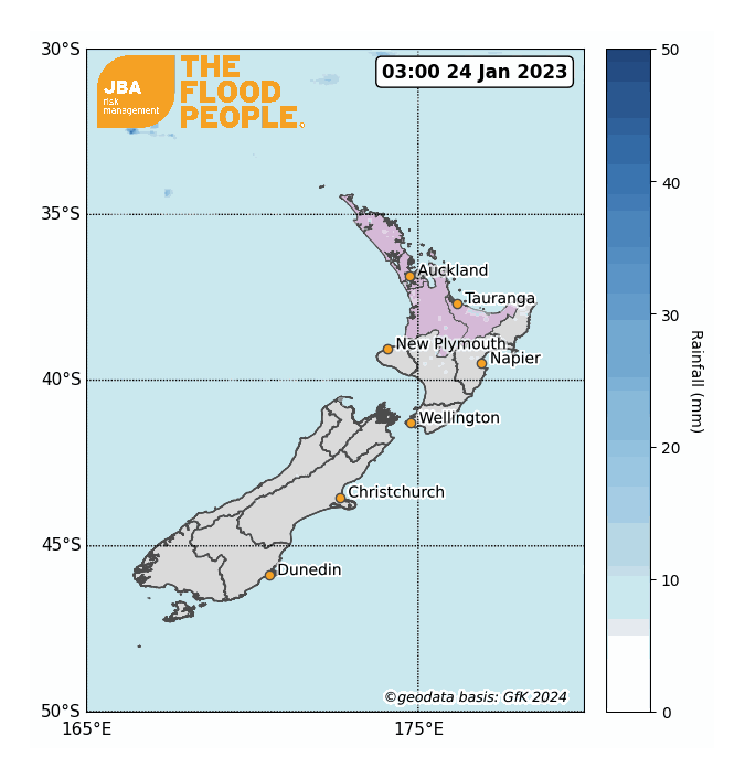
On 25 and 26 January, WeatherWatch and MetService issued forecasts for heavy rain and orange weather warnings for the Auckland area over the following weekend. Heavy rain began to fall over Auckland during the early hours of 27 January; by late afternoon, severe flash floods were occurring across the city with West Auckland and North Shore being the worst affected areas. Hours later, Mayor Wayne Brown declared a state of emergency due to widespread flooding (Stuff, 2023b). By 10:00 pm that evening, many locations across Auckland were registering record daily rainfalls, with 238mm reported at the Museum of Transport and Technology, 260mm reported in Albany and 242mm in Māngere (MetService, 2023).
On 28 and 29 January rain spread south of the Auckland area causing flooding in Waikato and Bay of Plenty (Stuff, 2023c). On 31 January, NIWA forecast that the atmospheric river would move across Auckland once more and issued a red heavy rain warning for the Northland Region (NZ Herald, 2023a).
Impacts
As of 31 January, four people have lost their lives (RNZ, 2023) and over 5,000 homes have been damaged by floods or landslides (Stuff, 2023b). All educational institutes in Auckland were directed to close for physical lessons between 30 January and 1 February (Ministry of Education, 2023).
Transport networks were also affected by the flooding. Six runway lights were damaged at Auckland Airport on 27 January when the severe weather impacted the landing of an Air New Zealand Boeing 777 aircraft; the airport was closed due to flooding later that day. Flooding also caused multiple road closures on several state highways, and a bridge on Mill Flat Road was washed away (Stuff, 2023b; Stuff, 2023d; Stuff, 2023e).
The insured losses for this event are anticipated to exceed the NZ$97 million ($63 million USD) cost of the 2021 New Zealand West Coast floods (Reuters, 2023).
Notable previous events
Aside from earthquakes and droughts, floods are one of New Zealand’s most expensive natural disasters, costing on average around NZ$133 million ($85 million USD) a year between 1968 and 1998 (Hennessy et al., 2007). Between 1968 and 2017, the country experienced over 80 damaging floods. An overview of the most recent floods is shown in Table 1, including details of precipitation records and overall losses.
Table 1: A summary table of some notable floods in New Zealand from 2004 to 2021.

Return period analysis
JBA conducted Extreme Value Analysis on historic rainfall data in order to estimate the return period of the event, focusing on downtown Auckland. We fit a Weibull distribution to a 31-year daily rainfall data timeseries from Auckland Council (2023) to produce a rainfall exceedance probability curve for the Albert Park rainfall station in the Auckland Central Business District. The curve is shown by the solid orange line in Figure 2, with the 70th percentiles given by the dashed lines. The observed 24-hour rainfall total of 281mm for 27 January at Albert Park (shown by the blue line) suggests around a 1-in-100-year rainfall event at this location.

Climate change
As the Earth’s atmosphere warms up, the amount of moisture that can be stored within it increases – a rise in temperature of a single degree Celsius means that the air can hold an additional 7% of water vapour (NASA, 2022). When storms occur, the surrounding air is sucked into a central region of low pressure, and the additional moisture results in more intense storms with heavier rainfall. A review of 15 different climate models by Fischer et al. (2014) concluded that New Zealand is expected to experience a 4-6% increase in heavy precipitation events per degree of warming by the end of the century under a high emissions scenario.
Air temperatures in New Zealand have warmed by around 0.5°C since 1950 (Fitzharris, 2007). A report by the Intergovernmental Panel on Climate Change (Hennessy et al., 2007) summarised the projected climate of New Zealand during the 21st century:
- Temperature rises of up to 1.4°C are likely by 2030 and up to 4.0°C by the 2080s;
- Frequency and intensity of extreme events (floods, landslides, storm surges and droughts) are likely to increase;
- Snow and frost are expected become less frequent.
Fernandez and Golubiewski conducted a geospatial-statistical study in 2019 to assess Auckland’s vulnerability to climate change. Their report concluded that “vulnerability hotspots” - defined as places experiencing the greatest impacts from climate change and with the lowest adaptive capacity – are located south of the Auckland isthmus and in parts of western Auckland, providing insight into areas where climate resilience and adaptation would benefit from further development.
Conclusion
According to New Zealand’s first national climate change risk assessment from 2020, 675,500 New Zealanders are currently living in flood prone areas. This number increases by 72,065 people when factoring in the most extreme effects of sea level rise (Ministry for the Environment, 2022; The Conversation, 2023). This has prompted Tower to become the first insurer to introduce risk-based pricing for flood insurance, based on the property’s risk to surface water flooding and river flooding (NZ Herald, 2023b).
JBA’s Flood Modelling offers clients the opportunity to understand their risk by running their portfolio against this event footprint or a simulated event set produced by JBA to calculate losses net of their insurance and reinsurance structures. To find out more about our flood data and how it can help you, get in touch with the team.
The report is accompanied by a flood footprint for the event, detailing extents and depths of the flooding in areas affected. JBA license these footprints on a commercial basis, for more information please email eventresponse@jbarisk.com.
This report is covered by JBA’s website terms – please read them here.
Update: Cyclone Gabrielle
As communities in New Zealand began to recover from the January 2023 floods, the country was struck by Cyclone Gabrielle which brought more flooding and landslides from 12 February 2023. The worst damage was found in the area of Hawke’s Bay, a popular tourist destination on the east coast of North Island.
On Tuesday 14 February a national state of emergency was declared, something that has previously only happened twice in New Zealand, at the outset of the Covid-19 pandemic and following the earthquake that hit Christchurch in 2011 (BBC, 2023).
By 16 February six people were known to have lost their lives, including a child, and two firefighters hit by a landslide while performing their duties. Over 9,000 people had been displaced from their homes, and Prime Minster Chris Hipkins warned of the likelihood of further fatalities as over 3,000 people were still listed as uncontactable by police (NZ Herald, 2023c).
The prime minister compared the impact of the storm to that of the Christchurch earthquake, and said that it would force New Zealanders to re-evaluate their response to extreme weather events, with infrastructure now needing to be rebuilt in a more resilient way (Guardian, 2023). The climate minister, meanwhile, has attributed the scale of the disaster as directly attributable to climate change (BBC, 2023).
JBA can help you to understand your view of flood risk
To better understand the impact of climate change on New Zealand flood risk going forwards, JBA has a suite of Flood Data and Probabilistic Flood Models available that represent both baseline and future flood risk. These data and models provide in-depth insights into the potential impact of climate change on flood risk to help users from across the financial and disaster risk reduction sectors. These data combine the highest resolution flood mapping available with modelling the severity and frequency of rainfall and river flooding under a range of future climate scenarios. Figure 3 shows examples of JBA’s 30m river and surface water flood hazard maps surrounding the affected area of Napier for return periods of 200 and 1,500 years. For more information, please visit the link here or get in touch.


