
Hurricane Idalia inflicts widespread damage in Florida
This summer, the weather event named Idalia tore into Florida as a powerful hurricane, before heading to Georgia and the Carolinas as a tropical storm. Described as the strongest weather event to hit Florida’s Big Bend region in 100 years, Idalia flooded streets, toppled power lines, and destroyed homes (NBC News, 2023). At least three people are known to have died in rain-related incidents so far (Al Jazeera, 2023). More than 225,000 households suffered power cuts in Florida with 230,000 losing power in Georgia (BBC, 2023). President Joe Biden was quoted as saying "I don't think anybody can deny the impact of the climate crisis anymore," in connection with the event (Reuters, 2023).
Event overview
Having made landfall at 07:45 ET near Keaton Beach on 30 August, Idalia is the second hurricane to hit Florida in under a year. Idalia weakened as it moved inland across northern Florida and was downgraded to a tropical storm after moving into Georgia and the Carolinas. The previous hurricane, Ian, lashed the state in late September 2022, leading to estimated economic damages of over $100 billion.
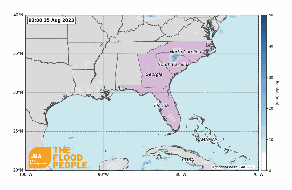
Idalia brought extreme rainfall to areas along its path, from Florida to North Carolina, with some parts receiving more than 250mm (10 inches) of rain (New York Times, 2023). Multiple airports including St Pete-Clearwater and Tampa were closed when Idalia hit the Gulf Coast, with hundreds of flights being cancelled. Train services were also severely affected due to the weather event (CNN, 2023b).
Meteorological overview
In May 2023 the National Oceanic and Atmospheric Administration (NOAA) predicted a “near normal” hurricane season due to the arrival of the El Niño weather pattern. This brings increased vertical wind shear which typically suppresses the strengthening of a hurricane. This prediction was updated in August by NOAA when considering the exceptionally warm ocean temperatures that have been recorded this year. Surface water temperatures were recorded as more than 38 degrees Celsius in some parts of Florida, thus combatting the moderating effects El Niño can have (Al Jazeera, 2023b).
Idalia’s rapid intensification drove the hurricane up the scale to a category 4 event before then reducing to category 3 prior to landfall. This is due to the hurricane replacing its eyewall, a common occurrence within the eye of a hurricane in which the wall collapses and a new eyewall forms creating a larger eye. This increases intensification of the hurricane, however the timing of the collapse meant that Idalia weakened before reaching land and reduced to category 3 (Independent, 2023).
Impacts from Hurricane Idalia
Florida
Two deaths have been recorded as being caused by two separate accidents related to the weather conditions (CNN, 2023). Power outages were reported across most of the north-west of the state with up to 80% of residents without power in Big Bend region counties such as Levy, Taylor, Dixie and Citrus (NBC News, 2023b) with 31% of households in Taylor still having no power as of 5 September (Power Outage, 2023). Around 6,000 homes were flooded in Pasco County causing major damage with water at least 450mm (18 inches) high (CNN, 2023).
Water levels near Cedar Key reached 2.1m and the storm surge was 2.7m (CNN, 2023). The storm surge further south in Clearwater and Tampa was around 1m. An estimated 2,000 homes were damaged by 1.5m of water inundation in Pasco County (Pasco County Emergency Management, 2023).
Georgia
One storm-related death was recorded as heavy winds hit Georgia (CNN, 2023). Although Georgia’s Hurricane Warning was downgraded to a Tropical Storm Warning by Wednesday evening, 15,000 residents were still without power the following day and told the situation may continue for up to a week. Homes were damaged by fallen trees and one house fire was reported (GPB News, 2023).
North and South Carolina
South Carolina had around 35,000 residents’ homes without power late into 30 August (NBC News, 2023b) and North Carolina had 79 roads closed due to flooding from the 50-150mm (2-6 inches) of rain received. Charleston recorded the fifth highest water levels at the harbour (NWS, 2023) with levels reaching higher than 2.7 metres (CNN, 2023).
JBA has conducted Extreme Value Analysis on historic rainfall data from Florida, Georgia and South Carolina in order to estimate the return period of the event. We fit a weibull distribution to 42-year daily rainfall climate data timeseries from NOAA (2023) to produce a rainfall exceedance probability curve. The curves are shown by the solid orange line in Figure 2, with the 70th percentiles given by the dashed lines. The observed 24-hour rainfall total of 138mm at the Plant City station in Florida on 30 August 2023 (shown by the blue line in Figure 2a, NOAA, 2023) suggests a greater than 1-in-25-year rainfall event at this location. For Valdosta Airport in Georgia, 180mm of rainfall was recorded on 31 August 2023 and this suggests a 1-in-50-year rainfall event. Mullins in South Carolina received 234mm of rainfall on 31 August 2023, indicating a 1-in-150-year rainfall event.

Are more major hurricanes hitting the USA
Hurricane Idalia was the eighth major hurricane (category 3 or higher) to make landfall in the US since 2017 (Figure 2). Prior to 2017 the last major hurricane to make landfall in the US was Hurricane Wilma in 2005. Extreme value analysis of US hurricane landfalls since 1851 shows that in any given year there is roughly a 33% chance of a category 3 hurricane making landfall, a 10% chance for category 4, and a 1.4% chance for category 5.


While the frequency of hurricanes and tropical storms impacting the region is not projected to increase, the intensity of the events globally is reported to have increased by 8% per decade in the past 40 years (Kosin et al., 2020) with further intensification anticipated in the future. Increases in hurricane intensity will be driven by a combination of a warming atmosphere, warming oceans and sea-level rise. Storm surge events will increase in the Big Bend region of Florida due to sea-level rise.
By 2100, under a moderate emissions scenario, projections suggest that the 1 in 100-year sea-level extremes could be between 2-3 metres, which is between 0.2m and 0.5m higher than today (Coastal Futures, 2023). Rainfall rates during hurricanes will continue to increase because a warmer atmosphere can hold more moisture, and warming ocean temperatures are contributing to more rapid intensification, resulting in more storm events becoming category 3 or greater (GFDL, NOAA, 2023).
JBA Flood Hazard Maps
JBA have national 5m resolution river, surface water and coastal storm surge flood hazard maps for the US. Figure 4 shows that JBA’s storm surge flood footprint for the event - detailing extents and depths of the flooding in areas affected. Download it via our Client Portal or request a copy by emailing eventresponse@jbarisk.com.


