
Hurricane Ian causes havoc in Florida:
28 September - 1 October 2022
Hurricane Ian, one of the strongest and costliest hurricanes in US history, hit Florida on 28 September 2022 and made its second US landfall two days later in South Carolina. The death toll passed 110 and is expected to keep rising, whilst 700,000 homes and businesses remained without power four days later in Florida alone (Guardian, 2022a). The residents of Florida and the Carolinas are facing a recovery that is expected to cost billions of dollars (Reuters, 2022a). The largest ever search-and-rescue effort was launched by the Federal Emergency Management officials (NBC News 2022). President Joe Biden visited the storm-affected areas in Florida and stressed the need for a united state and federal effort for the recovery (Reuters, 2022b).
EVENT TIMELINE
Ian, the first hurricane to make landfall in mainland US this year, began life on 19 September as a Tropical Disturbance in the North Atlantic, east of Barbados, where warm sea surfaces provided fuel in the form of moisture and unstable air. The weather system travelled west through the Caribbean Sea, intensifying into a Tropical Depression on 23 September. The storm then pivoted and tracked northwards, strengthening as it progressed, making landfall over western Cuba in Pinar del Rio Province as a Category 3 Hurricane on 27 September (Associated Press News, 2022a; UN News, 2022).
As Ian travelled north over the Gulf of Mexico, the storm system continued to strengthen, gaining Category 4 – or “Major” - Hurricane status. Ian made landfall near Cape Coral on Florida’s Gulf Coast on 28 September (Channel News Asia, 2022). Once Ian made landfall, its fuel supply of warm, moist air from below was removed, and the system rapidly diminished in strength as it continued to travel north-east across the Sunshine State. By 29 September, Ian was downgraded to a Tropical Storm as it moved offshore into the western Atlantic (CNBC, 2022).
Later that same day, Ian strengthened over the Atlantic Ocean, becoming a Category 1 Hurricane as it made a second landfall near Georgetown, South Carolina on 30 September (CBS News, 2022). The chronological development of Ian is shown in Table 1.
Table 1: Development of Hurricane Ian (Source: Wunderground, 2022; CBS News, 2022; Live Science, 2022; Channel News Asia, 2022; Associated Press News, 2022b).

METEOROLOGICAL OVERVIEW
Hurricanes form over sea surfaces with a minimum temperature of 26°C. The temperature difference between the air and the water creates unstable conditions that result in the formation of a low-pressure system, which is continually fueled from below by large quantities of water vapour evaporating from the sea surface. The rising moisture produces deep clouds that generate thunderstorms and heavy rainfall and, if the system grows large enough, it can begin to rotate, generating high wind speeds as air is pulled in towards the centre of the storm in a spiralling manner.
A hurricane’s strength is measured by its wind speed and follows the Saffir-Simpson scale which ranks from Category 1 (the weakest) to Category 5 (the strongest). Hurricane Ian underwent a process known as rapid intensification as it travelled over the Caribbean Sea. This process is defined by the National Hurricane Center as a system whose maximum sustained winds increase by at least 34mph in a 24-hour period (NHC, 2022a). The driving force behind Ian’s rapid intensification was the warm sea surface temperatures in this area, almost 2°C warmer than usual (Public Broadcasting Service, 2022).
The development of a hurricane is influenced by something known as wind shear, which defines how much the wind speed and direction varies throughout the lowest part of the atmosphere where the hurricane forms. High wind shear can disrupt the spiral structure of a hurricane and shorten its lifespan; conversely, regions with low wind shear – such as the Caribbean Sea at the time of Hurricane Ian’s approach - provide favourable conditions for a hurricane to grow and flourish (Live Science, 2022).

Once a hurricane makes landfall, the system begins to lose strength as its fuel source of moisture and warm air is removed. However, Ian passed over Cuba within a short timeframe (approximately six hours) and quickly entered the Gulf of Mexico – this meant it quickly encountered a further supply of fuel and continued to grow in strength. Once Ian made landfall in Florida, it weakened to a tropical storm before entering the Atlantic Ocean just north of Cape Canaveral (Associated Press News, 2022b). Over the Atlantic Ocean, Ian regained power a second time, making its second US landfall in South Carolina as a Category 1 hurricane, before finally weakening to a post-tropical cyclone (NPR, 2022a; Associated Press News, 2022c).
Hurricane activity also can be affected by the La Niña phase of the El Niño Southern Oscillation. The third consecutive year of the La Niña phase is underway, an exceptional event that has occurred for the first time in this century (NPR, 2022b). La Niña conditions are typically associated with higher temperatures and lower wind shear across the Atlantic which prove favourable for hurricanes developing close to the Caribbean, the Gulf Coast and the Gulf of Mexico (SciJenks, n.d.; The Hill, 2022). In August 2022, scientists at Colorado State University predicted that this year’s Atlantic hurricane season will be more active than usual, primarily due to the ongoing La Niña conditions (Colorado State University, 2022).
IMPACTS FROM HURRICANE IAN
Cuba
Ian caused the entire electrical grid to fail, resulting in a power outage for the entire island, possibly the first time this has happened. Pinar del Rio province, an important area for growing cigar tobacco, was destroyed. Finca Robaina, one of the most prestigious tobacco farms in Cuba was also damaged (Associated Press News, 2022a). According to official numbers, three people have died and 40,000 people were evacuated, and initial surveys have indicated that over 100,000 homes were damaged or destroyed (Fox Weather, 2022a; Reuters, 2022c). Prior to Ian’s arrival, Cuba was already enduring an economic crisis and suffering from food, fuel and medicine shortages (Associated Press News, 2022a; The Economic Times, 2022) - the impact of Ian will further aggravate the situation for a population already in difficulty.
Florida
Two and a half million residents of Florida were under evacuation orders and over 2.2 million people suffered from power outages. So far, at least 105 people have died, and many were trapped, with over 2,300 rescues conducted (Guardian, 2022b; NBC News, 2022b; CNN, 2022b).
Many streets in Naples became impassable due to flooding and high tides. Dozens of hospitals and nursing homes were forced to evacuate patients when the hurricane cut off access to clean water or, in the case of the HCA Florida Fawcett Hospital, they became flooded. Flights to and from Jacksonville International Airport, Orlando International Airport and Tampa International Airport were cancelled, and the Sanibel Causeway - connecting Sanibel Island to mainland Florida - was damaged, with some portions collapsing and others washed away (Naples News, 2022; Guardian, 2022b; The Conversation, 2022; CNN, 2022b; The New York Times, 2022).
North and South Carolina
So far, four deaths have been reported in North Carolina, and over 200,000 residents in both North and South Carolina suffered from power outages. Four piers along South Carolina’s coast were washed away in the storm surge, including those on Pawleys Island and North Myrtle Beach. Floods up to knee-high depths were observed in parts of Charleston, South Carolina (CNN, 2022b; Greenville News, 2022; WXII 12 News, 2022; WCNC, 2022).
EXTREME RAINFALL ANALYSIS
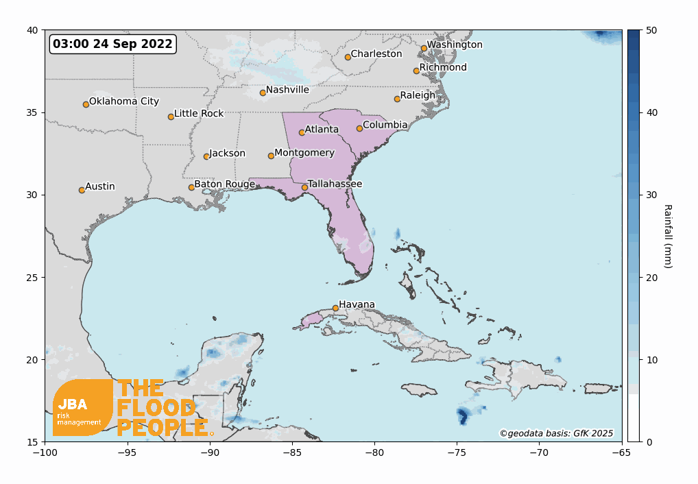
After Hurricane Ian made landfall in Florida, Orlando recorded a record-breaking 12.49 inches (317mm) of rain from 28 to 29 September 2022 which resulted in heavy floods near Kissimmee (Yale Climate Connections, 2022). JBA conducted extreme rainfall return period analysis for this location using NOAA National Climatic Data Center daily climate summaries (NOAA NCDC, 2022). An exponential distribution curve was fitted to the historical data to give an exceedance probability curve, shown by the solid orange line in Figure 3, with the 70th percentiles given by the dashed lines. Based on the exceedance probability curve, the observed rainfall over Orlando (shown by the blue line) is estimated to be reflective of a greater-than 1-in-1000-year event.

HISTORICAL EVENTS
As the state with the longest coastline in the continental US, as well its location within the warm and humid tropics, Florida is particularly susceptible to hurricanes. Over 41% of all hurricanes in the US have made landfall across the state, with Ian being the 121st to hit Florida since 1851. Florida also experiences high financial losses when hurricanes strike due to the fact that 76% of its population live in coastal areas, making them vulnerable to storm surge (The Washington Post, 2022).
Table 2. Historical flood events and their impacts across Florida.

RETURN PERIOD AND LOSS ESTIMATION
In a press briefing, Ron DeSantis, Governor of Florida, called the hurricane’s rainfall a 500-year flood event, commenting that “the impacts of this storm are historic” (WSUF Public Media, 2022). In areas like Placida and Lake Wales in Florida, the observed rainfall exceeded the 1-in-1,000-year flood return period (CNN, 2022a).
Loss estimates for the event by different companies vary significantly. In terms of insured losses, some of the estimated figures are $25-40 billion (Fitch Ratings, 2022), $42-57 billion (Verisk, 2022), $53-74 billion (RMS, 2022) and $63 billion (Karen Clark & Co., as noted in Bloomberg, 2022). Karen Clark & Co. have additionally estimated economic damages of over $100 billion (Bloomberg, 2022).
JBA FLOOD HAZARD MAPS
JBA have national 5m resolution river, surface water and coastal storm surge flood hazard maps for the US, as well as 30m resolution river and surface water maps for Cuba. Figure 4 shows that JBA’s storm surge flood map with a return period of 500 years captures areas known to have flooded as a direct result of coastal surge from Hurricane Ian.

It’s vital that organisations act now in response to flood risk. JBA offers flood mapping and probabilistic flood modelling worldwide, including for the US. Our data provides flood risk insights at any location globally. This can help re/insurers, financial organisations, and the International Development sector to better understand and manage flood risk.
JBA’s unique Global Flood Model offers clients the opportunity to run their portfolio against this event footprint and other event footprints produced by JBA to calculate losses net of their insurance and reinsurance structures. To find out more about our flood data and how it can help you, get in touch with the team.
The report is accompanied by a flood footprint for the event, detailing extents and depths of the flooding in areas affected. To request a copy please email eventresponse@jbarisk.com.
This report is covered by JBA’s website terms – please read them here.


