
South Africa experiences extensive autumn flooding
Successive low-pressure systems brought destructive flooding, landslides and damaging winds to large parts of South Africa during May 2026, causing fatalities, widespread damage to buildings and major infrastructure disruption across long stretches of coastline and interior provinces. Rainfall totals exceeded 300 mm in some areas, inundating communities, isolating towns and disrupting businesses, while transport, electricity and agricultural sectors experienced significant disruption (The Guardian, 2026).
The event is particularly notable due to the scale and persistence of the flooding, the exposure of vulnerable communities and critical infrastructure, and the growing financial pressures associated with South Africa’s widening flood protection gap.
For insurers, reinsurers, lenders and public-sector stakeholders, the floods highlight the increasing importance of high-resolution flood risk data, and probabilistic catastrophe modelling in understanding and managing flood risk across Southern Africa.
Meteorological overview and timeline
The May 2026 South Africa floods were triggered by a succession of intense low-pressure systems affecting the southern and interior regions of the country, particularly the Western Cape and Eastern Cape provinces. While such systems are not uncommon during the austral autumn, the severity of this event was exceptional due to the rapid intensification of the systems, their slow movement, and the persistence of high rainfall totals over already saturated catchments.
The first major system developed rapidly between 5 and 6 May 2026 across the Eastern Cape (Figure 1). Its formation was driven by a cut-off low in the mid- to upper-troposphere, which enabled a plume of warm, moist air from the Indian Ocean to move southwards across southern Africa. This interaction deepened the surface low-pressure system and generated widespread convective activity, resulting in severe thunderstorms with heavy rainfall (EUMETSAT, 2026; Met Office, 2026).
At the same time, a ridge of high pressure strengthened over Namibia and parts of the Northern Cape. The strong pressure gradient between the two systems generated damaging winds, with gusts exceeding 97 km/h in exposed areas and mountainous terrain (EUMETSAT, 2026; The Guardian, 2026).
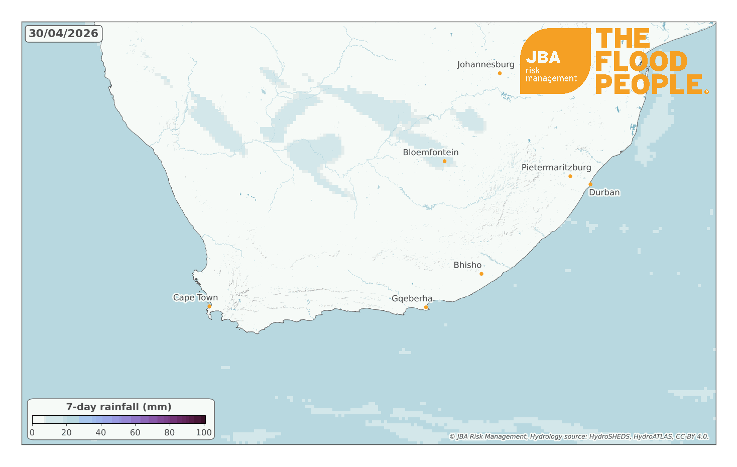
Figure 1 shows the slow-moving low-pressure system that allowed an occluded front to remain stationary over the Eastern and Western Cape between 6 and 7 May, continually feeding moisture into the region and producing extreme rainfall accumulations (Met Office, 2026). Throughout the event between 6 to 12 May, satellite-derived rainfall total estimates exceeded 300 mm in some locations, particularly across parts of the Eastern Cape and Garden Route region (Figure 2).

A second significant series of low-pressure systems affected the country from 10 May onwards (Figure 1). These systems were associated with intense cold fronts and heavy downpours, approaching from the west from over the South Atlantic Ocean. Driven by an intensification and amplified loop in the Southern Hemisphere polar jet stream, the cold fronts brought further persistent heavy rainfall to the Western and Northern Cape.
Between 6 and 12 May, mountainous regions of the Western Cape received up to an estimated 600 mm of rainfall, exacerbating flooding impacts in areas already affected by the earlier storm systems (Figure 2).
Impacts of the floods
As of 12 May 2026, at least ten fatalities had been reported following the flooding and strong winds (AP News, 2026). The floods have caused widespread disruption and damage across South Africa, affecting at least six provinces, including the Western Cape, Eastern Cape, Northern Cape, Free State, North West and Mpumalanga (Reliefweb, 2026).
Across the Garden Route District and other parts of the Western Cape, the storms caused major damage to transport and utility infrastructure. Floodwaters, fallen debris and landslides led to 45 reported road closures, widespread power outages and the forced evacuation of more than 2,000 people in Gamtoos Valley after the Kouga Dam exceeded capacity (The Guardian, 2026).
Relief organisations distributed emergency food parcels and blankets to affected residents where access remained possible (BBC, 2026). One fatality was recorded in Knysna in the Western Cape (Reliefweb, 2026).
The second storm system, which struck from 10 May onwards, brought further fatalities and displacement. Media reports indicated at least five deaths in Cape Town due to flooding and fallen trees and approximately 83,000 residents were reported affected (The South African, 2026). The city also saw the closure of schools, flooding in 26 informal settlements, and damage to 10,000 properties (AP News, 2026).
The South African Weather Service issued multiple warnings throughout the event, highlighting the risks of flash flooding, landslides and snowfall. Gale force winds accompanying the rainfall exacerbated impacts, particularly in Cape Town and mountain regions such as Drakenstein, Stellenbosch and Witzenberg (Daily Maverick, 2026).
The Breede River in the Western Cape’s Winelands district burst its banks, flooding multiple vineyards as the heavy, prolonged rainfall that fell upstream began swelling the river downstream. For one producer, 15 hectares of new vineyards planted last year, and 1.3 million bottles of stock were inundated in up to 2 m of flood water (Harpers, 2026). The floods will certainly have financial impacts on the Western Cape wine industry, which contributes R50.9 billion to the national GDP and supports 245,000 jobs (SAWIS, 2024).
The event demonstrated the vulnerability of both urban and rural communities to extreme rainfall and highlighted the cascading impacts of severe flooding on infrastructure, transport and the agricultural sector across southern South Africa.
Rainfall information
Rainfall totals across the Cape region were exceptionally high, with several areas recording extreme short-duration rainfall far above the seasonal average. The Knysna Section of the Garden Route National Park observed 378 mm of rainfall, where monthly average rainfall totals typically range between 60 mm and 120 mm (South African National Parks, 2026).
Weather stations near Plettenberg Bay and Knysna recorded approximately 162 mm and 161 mm respectively, within 24 hours, while Cape Town’s long-term average rainfall for the entire month of May is approximately 136 mm (Cape Town Data, 2026). In the George area, three separate stations recorded between 92 mm and 137 mm within a single 24-hour period, despite May averages for George typically being around 75 mm (Cape Town Data, 2026).
Between 11 and 13 May, additional heavy rainfall affected already saturated mountainous regions of the Western Cape. South African Weather Service (SAWS) stations measured 69 mm within 24 hours at Ceres, where the average total rainfall for May is approximately 55 mm. Stations also recorded 24-hour totals of 52 mm at Kirstenbosch, close to Cape Town’s average monthly May total in less than a day, alongside approximately 34 mm at Paarl and 30 mm at Grabouw and Elim (South African Weather Service, 2026).
The SAWS bulletin additionally reported that all 72 monitored stations recorded measurable rainfall, while 18 stations recorded heavy rainfall totals above 20 mm, and two exceeded 50 mm within 24 hours (South African Weather Service, 2026).
Notable historical events
The May 2026 floods form part of a series of significant flood disasters that have affected South Africa in recent years across regions, including the Western Cape, Eastern Cape, KwaZulu-Natal and the country’s interior.
One of the earliest major events was the 1987 Durban floods, one of the most severe rainfall events recorded in KwaZulu-Natal. More than 300 mm of rain within 48 hours fell across parts of Durban, triggering widespread flash flooding and landslides in steep urban areas. The event caused over 300 deaths and left thousands homeless, with informal settlements particularly vulnerable due to their location on unstable slopes and flood-prone land (South African Weather Service, 2023).
The KwaZulu-Natal floods in April 2022 remain the costliest and most significant recent flood disaster in South Africa. Extreme rainfall of approximately 200 to 400 mm in 24 hours led to catastrophic flooding and landslides. The disaster resulted in 443 deaths and displaced more than 40,000 people. Widespread damage was reported to residential buildings, transport networks, water infrastructure and the Port of Durban. Total economic losses were estimated at US$1.5–1.7 billion, making it one of the most expensive natural disasters in South African history (Department of Cooperative Governance and Traditional Affairs, 2022).
More recently, the 2023 Western Cape floods caused extensive disruption across Cape Town and surrounding areas after heavy rainfall totals of 193 mm within 48 hours. More than 16,000 people were affected and over 7,000 informal structures were damaged, with agricultural and infrastructure losses estimated at over US$75 million. The disaster highlighted the vulnerability of informal settlements and the limitations of urban drainage systems in rapidly growing urban areas (The Guardian, 2023; Reuters, 2024).
Other historic events summarised in Table 1 include the 2011 floods across Northern South Africa that caused US$300–500 million in losses (Department of Cooperative Governance and Traditional Affairs, 2011), and the 2019 Easter Floods in KwaZulu-Natal, which caused at least 70 deaths and destroyed more than 1,000 homes (South African Weather Service, 2019).

Industry insight
Based on economic losses from recent historic flood events, the May 2026 floods are likely to be a multi-million US dollar loss event. The storms made landfall in quick succession and impacted parts of the country. The losses are likely to be driven by public infrastructure damage, residential property losses, business interruption and emergency response costs.
Insured losses are expected to be lower than total economic losses, reflecting South Africa’s estimated 71% natural catastrophe protection gap (SA News, 2025). Flood insurance penetration remains particularly low in rural communities and informal settlements where the May 2026 floods caused the most severe impacts (Lefutso et al., 2025). As a result, much of the losses will likely fall on households, businesses and the national government rather than insurers and reinsurers (Daily Investor, 2025).
In addition, it was highlighted during the South African Reserve Bank’s 2024 Climate Risk Stress Test that the country’s wider financial system is vulnerable to climate-related risks such as flooding, including increased damage to property and infrastructure, and significant data and modelling gaps among the country’s largest banks. This means South Africa’s lender and property markets are also vulnerable to flood risk due to property damage, reduced property values, uninsured repair costs and the uneven concentration of risk in flood-prone areas (South African Reserve Bank, 2025).
Against this backdrop, the May 2026 floods reinforce the importance of probabilistic flood risk assessment using catastrophe modelling in understanding potential loss drivers beyond historical experience alone. Catastrophe models are critical for quantifying portfolio exposure, estimating losses across different return periods, and supporting risk management decisions. These decisions are critical for underwriting, asset management, scenario analysis and resilience planning for insurers, reinsurers, financial institutions and public-sector stakeholders.
These approaches also underpin sovereign and parametric disaster risk financing mechanisms, where predefined flood severity or river flow thresholds can trigger rapid financial support following major flood events. Programmes such as African Risk Capacity (ARC) demonstrate how probabilistic flood modelling can support contingency planning, early action and faster access to recovery funding, helping reduce humanitarian impacts and improve disaster response following severe events such as the May 2026 floods.
Conclusion
The May 2026 South Africa floods were an exceptional event due to the rapid intensification of multiple low-pressure systems and high rainfall totals over saturated catchments. The floods highlight the growing financial and humanitarian impacts of severe flooding across the region, particularly in areas of low insurance penetration and high property and infrastructure exposure and vulnerability.
The event reinforces the importance of supporting underwriting, portfolio management, climate stress testing and disaster resilience planning in preparing for severe flood events. JBA’s high-resolution flood hazard data and probabilistic flood risk modelling help financial and public sectors identify exposed assets, quantify potential losses and better understand both current and future flood risk.
This report is accompanied by a flood footprint for the event, detailing extents and depths of the flooding in areas affected in South Africa. Download it via our Client Portal or request a copy by emailing eventresponse@jbarisk.com.


